

G-Tracker - GPS Logger

G-Tracker - GPS Logger ၏ ရွင္းလင္းခ်က္
G Tracker is an application that uses Android's built-in GPS to track the current position.
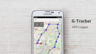
It is an application called so-called gps logger.
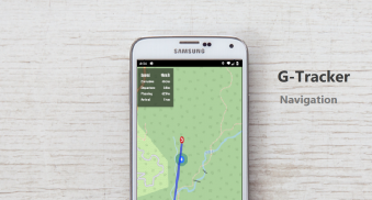
It also works as a gpx viewer and navigation app.
[About GPS Logger]
GPS logger is a device that records travel routes using GPS satellites.
If you move using a GPS logger, you can check what route you followed later.
You can use it for mountain climbing and cycling to check the passing area.
[Main usage]
Power saving and long time gps logger
gps logger for high battery consumption but detailed trajectory data recording
Confirm travel history and routes such as travel and cycling.
Navigation using travel history such as travel and cycling is possible
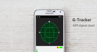
It is possible to see satellite information of gps.
You can see geotagged photos on the map.
Acquired records can be exported to GPX file and displayed by other applications
GPX files can be imported and used as GPX viewers.
[function]
Record route information.
Create route information.
Record location information at specified intervals.
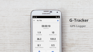
Graph display of speed and elevation
Confirmation of GPS satellite information
Create markers from geotagged photos.
Route information, route information, and waypoints are stored in internal memory (GPX).
Night mode support.
GPX file import
Display of photo marker
◇ Notes
Because GPS is used when recording route information, battery consumption is large.
Use openstreetmap for map display.
, G Tracker လက်ရှိအနေအထားကိုခြေရာခံဖို့က Android ရဲ့ built-in GPS စနစ်အသုံးပြုထားတဲ့ application ဖြစ်ပါတယ်။
ဒါဟာဒါခေါ် GPS logger ဟုခေါ်သည့် application ဖြစ်ပါတယ်။
ဒါဟာအစတစ် gpx ကြည့်ရှုသူများနှင့်အညွှန်း app ကိုအဖြစ်အလုပ်လုပ်ပါတယ်။
[GPS စနစ် Logger မှအကြောင်း]
ဂျီပီအက်စ် logger ဂျီပီအက်စ်ဂြိုဟ်တုကို အသုံးပြု. ခရီးသွားလမ်းကြောင်းမှတ်တမ်းတင်မယ့်ကိရိယာဖြစ်သည်။
သင်တစ်ဦး GPS စနစ် logger သုံးပြီးရွှေ့နေလျှင်, သင်အကြာတွင်နောက်တော်သို့လိုက်သောအရာကိုလမ်းကြောင်းစစ်ဆေးနိုင်ပါသည်။
သင့်အနေဖြင့်သွားတာဧရိယာစစ်ဆေးတောင်တက်ခြင်းနှင့်စက်ဘီးစီးခြင်းအဘို့အကကိုသုံးနိုင်သည်။
[ပင်မအသုံးပြုမှု]
ပါဝါကိုချွေတာခြင်းနှင့်အချိန်ကြာမြင့်စွာ GPS logger
မြင့်မားတဲ့ဘက်ထရီသုံးစွဲမှုအတွက် GPS logger ပေမယ့်အသေးစိတ်လမ်းကြောင်း data တွေကိုအသံဖမ်း
ခရီးသွားသမိုင်းနှင့်ယင်းသို့ခရီးသွားနှင့်စက်ဘီးစီးအဖြစ်လမ်းကြောင်းအတည်ပြုပါ။
navigation ထိုကဲ့သို့သောခရီးသွားနှင့်စက်ဘီးစီးအဖြစ်ခရီးသွားသမိုင်းကို အသုံးပြု. ဖြစ်နိုင်
ဒါဟာ GPS ဂြိုလ်တုမှအချက်အလက်တွေကိုမြင်တွေ့ဖို့ဖြစ်နိုင်ပါတယ်။
သင်ကမြေပုံပေါ်တွင်ပထဝီအချက်ဓာတ်ပုံများကြည့်ရှုနိုင်ပါတယ်။
ဝယ်ယူမှတ်တမ်းများ GPX ဖိုင်ကိုတင်ပို့နှင့်အခြား application များအားဖြင့်ပြသနိုင်ပါသည်
GPX ဖိုင်တွေတင်သွင်းခြင်းနှင့် GPX ကြည့်ရှုအဖြစ်အသုံးပြုနိုင်ပါသည်။
[function ကို]
စံချိန်လမ်းကြောင်းသတင်းအချက်အလက်။
လမ်းကြောင်းသတင်းအချက်အလက်ကိုဖန်တီးပါ။
သတ်မှတ်ထားသောကြားကာလမှာစံချိန်တင်တည်နေရာသတင်းအချက်အလက်။
အမြန်နှုန်းနှင့်မြင့်၏ဇယား display ကို
ဂျီပီအက်စ်ဂြိုဟ်တုအချက်အလက်များ၏အတည်ပြုချက်
ပထဝီအချက်ဓါတ်ပုံထဲကနေအမှတ်အသားများကိုဖန်တီးပါ။
လမ်းကြောင်းသတင်းအချက်အလက်, လမ်းကြောင်းသတင်းအချက်အလက်နှင့်အမှတ်များနှင့် internal memory (GPX) တွင်သိမ်းဆည်းထားသည်။
ညဥ့် mode ကိုထောက်ခံကြောင်း။
GPX ဖိုင်ကိုတင်သွင်း
ဓာတ်ပုံတစ်ပုံအမှတ်အသား၏ display
◇မှတ်စုများ
လမ်းကြောင်းသတင်းအချက်အလက်မှတ်တမ်းတင်သည့်အခါ GPS စနစ်အသုံးပြုသည်ဆိုသောကြောင့်, ဘက်ထရီသုံးစွဲမှုကြီးမားသည်။
မြေပုံ display ကိုအဘို့အ OpenStreetMap ကိုသုံးပါ။


